


11.6 km | 13.6 km-effort
![Trail On foot Týn nad Vltavou - [M] Bechyně - Židova strouha - Photo](https://media.geolcdn.com/t/1900/400/6448b7c9-0f0e-42ec-b862-9acf38988c27.jpeg&format=pjpeg&maxdim=2)

Tous les sentiers balisés d’Europe GUIDE+


FREE GPS app for hiking
 SityTrail
IGN / Geographical institutes
SityTrail World
The world is yours!
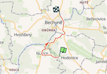
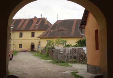
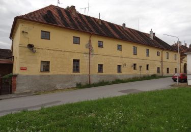
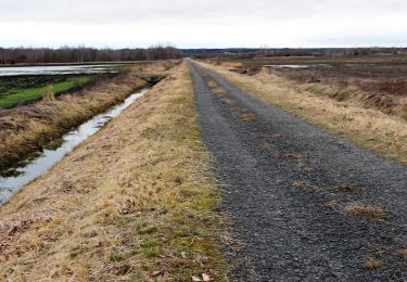
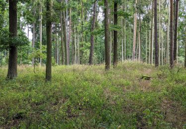
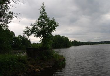
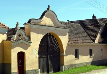
Trail On foot of 6.8 km to be discovered at Southwest, Jihočeský kraj, Týn nad Vltavou. This trail is proposed by SityTrail - itinéraires balisés pédestres.
Trail created by cz:KČT.
![Trail On foot Týn nad Vltavou - [M] Bechyně - Židova strouha - Photo 1](https://media.geolcdn.com/t/2048/auto/9048f8be-fde1-4c8a-bd2f-94fdf41b3569.jpeg&format=jpg&maxdim=0 "Trail On foot Týn nad Vltavou - [M] Bechyně - Židova strouha - Photo 1")
![Trail On foot Týn nad Vltavou - [M] Bechyně - Židova strouha - Photo 2](https://media.geolcdn.com/t/2048/auto/eb0b8273-851c-456a-8e38-4550cd7be275.jpeg&format=jpg&maxdim=0 "Trail On foot Týn nad Vltavou - [M] Bechyně - Židova strouha - Photo 2")
![Trail On foot Týn nad Vltavou - [M] Bechyně - Židova strouha - Photo 3](https://media.geolcdn.com/t/2048/auto/ac46f7f2-f8b0-4fc7-bb36-4939b581dc1b.jpeg&format=jpg&maxdim=0 "Trail On foot Týn nad Vltavou - [M] Bechyně - Židova strouha - Photo 3")
![Trail On foot Týn nad Vltavou - [M] Bechyně - Židova strouha - Photo 4](https://media.geolcdn.com/t/2048/auto/d3484809-02fd-4b28-8bd5-1270cb5f4756.jpeg&format=jpg&maxdim=0 "Trail On foot Týn nad Vltavou - [M] Bechyně - Židova strouha - Photo 4")
![Trail On foot Týn nad Vltavou - [M] Bechyně - Židova strouha - Photo 5](https://media.geolcdn.com/t/2048/auto/d6de1bb0-4142-484c-a3ca-e7c76d10e1a5.jpeg&format=jpg&maxdim=0 "Trail On foot Týn nad Vltavou - [M] Bechyně - Židova strouha - Photo 5")
![Trail On foot Týn nad Vltavou - [M] Bechyně - Židova strouha - Photo 6](https://media.geolcdn.com/t/2048/auto/5f4d76c4-2580-40ea-a023-6758d30dbe21.jpeg&format=jpg&maxdim=0 "Trail On foot Týn nad Vltavou - [M] Bechyně - Židova strouha - Photo 6")
![Trail On foot Týn nad Vltavou - [M] Bechyně - Židova strouha - Photo 7](https://media.geolcdn.com/t/2048/auto/7680f159-6536-4cc8-a302-8261b1b72074.jpeg&format=jpg&maxdim=0 "Trail On foot Týn nad Vltavou - [M] Bechyně - Židova strouha - Photo 7")
![Trail On foot Týn nad Vltavou - [M] Bechyně - Židova strouha - Photo 8](https://media.geolcdn.com/t/2048/auto/973d7cd4-2764-44fb-b65c-67858f27400f.jpeg&format=jpg&maxdim=0 "Trail On foot Týn nad Vltavou - [M] Bechyně - Židova strouha - Photo 8")
![Trail On foot Týn nad Vltavou - [M] Bechyně - Židova strouha - Photo 9](https://media.geolcdn.com/t/2048/auto/c66f57d8-c0e5-46e1-ba2f-d364d99246fd.jpeg&format=jpg&maxdim=0 "Trail On foot Týn nad Vltavou - [M] Bechyně - Židova strouha - Photo 9")
![Trail On foot Týn nad Vltavou - [M] Bechyně - Židova strouha - Photo 10](https://media.geolcdn.com/t/2048/auto/6448b7c9-0f0e-42ec-b862-9acf38988c27.jpeg&format=jpg&maxdim=0 "Trail On foot Týn nad Vltavou - [M] Bechyně - Židova strouha - Photo 10")
On foot
On foot
On foot
![Trail On foot Ševětín - [M] Ševětín - Velechvín - Photo](https://media.geolcdn.com/t/375/260/bce36fe7-b4ce-4198-93e2-1fa19f3b88bb.jpeg&format=jpg&maxdim=2)
On foot
On foot
On foot
![Trail On foot Zvíkovské Podhradí - [Z] Zvíkovské podhradí - Osek - Milevsko - Photo](https://media.geolcdn.com/t/375/260/56e1e425-6531-4f37-8934-d46ff5c33552.jpeg&format=jpg&maxdim=2)
On foot
On foot
![Trail On foot Sezimovo Ústí - [M] Sezimovo Ústí - Planá nad Lužnicí - Photo](https://media.geolcdn.com/t/375/260/5b6d0c4e-5d11-4cd9-9c2c-b6cbb176e445.jpeg&format=jpg&maxdim=2)
On foot